

Weave Raster Inquiry Tool
Cohga is pleased to announce the release of a new raster inquiry utility designed for the Weave platform. This utility allows users to perform raster statistical calculations using vector data inputs, offering practical applications such as measuring carbon footprints or flood heights in specific areas.
Configurable Capabilites
As with other Weave utilities, users have the flexibility to customize the tool's functionality through XML configuration settings. Currently, the Weave Raster Inquiry Tool is compatible with Oracle and PostGIS raster databases, and it can be easily adapted to work with other raster database systems like ArcGIS Image Server. This adaptability allows users to configure the tool for various calculations across different datasets, potentially spanning multiple database systems.
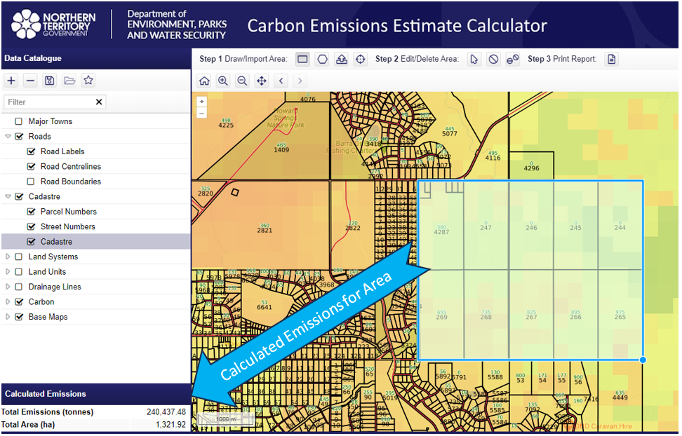
Example Site
This utility has recently been deployed for public use by the Department of Environment, Parks, and Water Security in the Northern Territory. They are utilizing it to measure Greenhouse Gas Emissions in designated areas, contributing to sustainable land management efforts. You can explore this system here https://nrmaps.nt.gov.au/carbon/carbon.html.
Summary
The release of the Weave Raster Inquiry Tool brings a useful resource for conducting raster calculations within the Weave platform. This tool offers flexibility for a wide range of tasks, from environmental assessments to geographic analysis. Its capacity to adapt and its practical use in environmentally important projects underscore its value across diverse fields.
Contact Us for further information about the Weave Raster Inquiry Tool.